Carlington
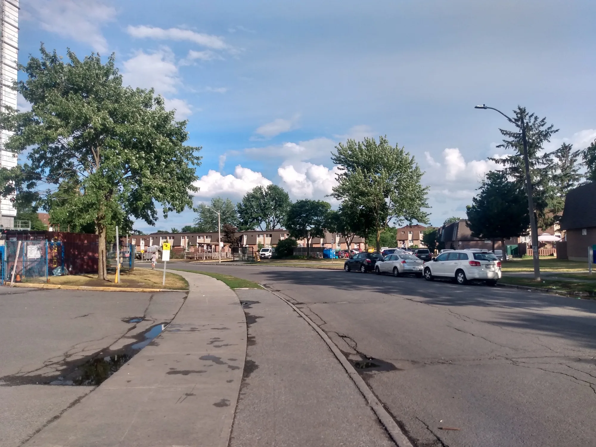
A post-war west-end neighbourhood around Carlington Hill and Carlington Park, with Merivale Road as its traditional main street.
* Ottawa Neighbourhood Study figures for its “Carlington” area, which is larger than Carlington alone.
Carlington is in River Ward in the west end of Ottawa. The Ottawa Neighbourhood Study's 'Carlington' area had 16,085 residents in the 2021 census.
Updated · Facts on this page link to their sources
About Carlington
Carlington is in River Ward in the west end of Ottawa. Wikipedia describes it as first settled in the early 1920s, with a large share of its homes built from 1945 to 1960, many as 'war homes' for returning veterans. Merivale Road runs through the centre of residential Carlington. The neighbourhood's best-known landmark is Carlington Hill, a large hill that was formerly a ski hill and is now a City of Ottawa approved sledding hill. Carlington Park, two community centres, several smaller parks and rinks, and the Experimental Farm pathway on the south edge give residents green space and recreation nearby. According to the ONS, 59.7% of households rent and 40.3% own, and the median age is 36.8 (2021 census).
Boundaries
Wikipedia gives the community association boundaries as Clyde Avenue to the west, Carling Avenue and the Queensway to the north, Fisher Avenue to the east and the Central Experimental Farm Pathway to the south. The Carlington Community Association also publishes maps at https://www.carlingtoncommunity.org/about-carlington/maps/. The ONS 'Carlington' boundary used for the 2021 figures is drawn separately, so its numbers may not match Wikipedia's older census figures exactly.
Homes
Wikipedia notes that most of the neighbourhood's early housing was built from 1945 to 1960, and that new homes are being built as some veterans' homes are demolished. In the ONS 'Carlington' area, the 2021 census counts 7,555 private dwellings: 24.0% single-detached houses, 7.7% semi-detached, 17.9% row houses, 1.8% duplex flats, 19.4% apartments in buildings under five storeys and 29.3% apartments in buildings of five or more storeys. Condominium dwellings are 7.0% of the total. 59.7% of households rent and 40.3% own. en.wikipedia.org ons-sqo.ca
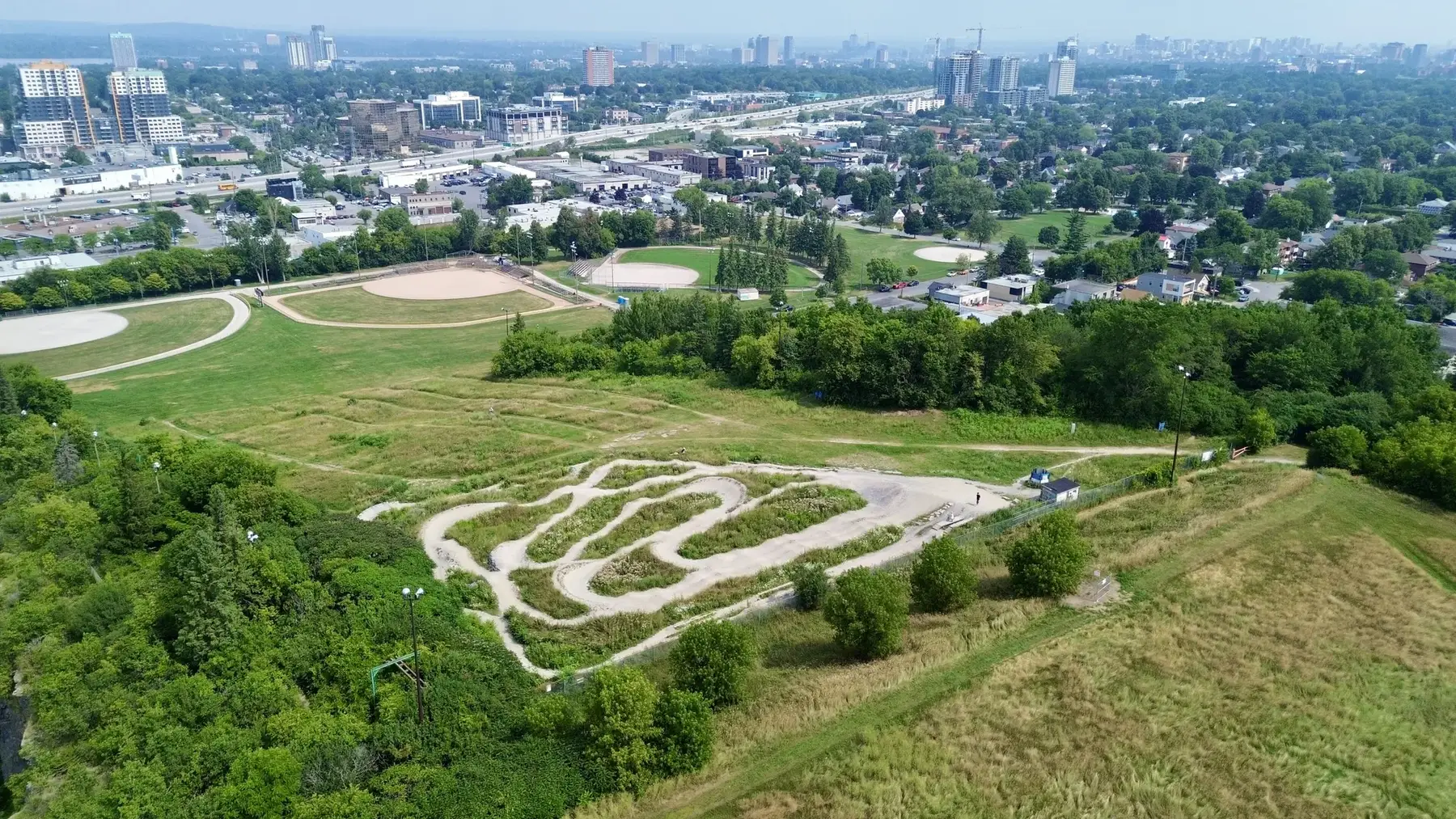
- Carlington Hill, a City of Ottawa approved sledding hill, sits beside Carlington Park, J. Alph Dulude Arena and four baseball diamonds (per Wikipedia)
- Two community centres: Alexander Community Centre and Carlington Recreation Centre
- Merivale Road is the traditional main street, with grocery and pharmacy options along it
- About 6.0 km in a straight line from Parliament Hill; 8.1 km by road, about 11 minutes free-flow with no traffic
- Five places of worship are listed on Wikipedia, including St Tekle Haimanot Ethiopian Orthodox Tewahedo Church, the only Ethiopian Orthodox church in Ottawa
- Housing mix per ONS (2021): 24.0% single-detached, 17.9% row houses and 29.3% apartments in buildings of five or more storeys
Community
How Carlington came to be
- 1920s
Carlington was first settled in the early 1920s and contains fewer than 435 older pre-1945 homes. en.wikipedia.org
- 1945–1960
About 2,000 dwellings were built from 1945 to 1960. Homes from the period right after World War II were meant for returning veterans and are known as 'war homes' or 'veteran homes'. Many street names reflect this military heritage, such as Viscount, Admiral, General, Marshall, Veteran and Crerar avenues. en.wikipedia.org
- 1961–1980
From 1961 to 1970, 1,440 homes and apartments were built, and from 1971 to 1980 another 1,380. After 1981 construction of new dwellings dropped sharply, to under 400 for the rest of the 20th century. Wikipedia notes new homes are now being built as some veterans' homes are demolished. en.wikipedia.org
Carlington Hill was formerly a ski hill with a tow lift (known as Anne Heggtveit Hill) and is now a City of Ottawa approved sledding hill. The western part of the hill was quarried for limestone, which was crushed for use in making cement, and the former quarry is now a city snow dump. The Carlington Heights Reservoir and Pump Station on top of the hill supplies approximately one third of the City's water. en.wikipedia.org
Around Carlington
Walking rings at 5, 10 and 15 minutes from the neighbourhood centre.
Schools
9 nearbyOttawa Torah Institute
1400 Coldrey Avenueopenstreetmap.org
660 m8 min walkRevel Academy
1550 Laperriere Avenueopenstreetmap.org revelacademy.ca
720 m9 min walkSt. Elizabeth School
OCSB1366 Coldrey Avenueopenstreetmap.org sel.ocsb.ca
770 m10 min walkW.E. Gowling Public School
OCDSB250 Anna Avenueopenstreetmap.org wegowlingps.ocdsb.ca ocdsb.ca
910 m11 min walkTurnbull School
1132 Fisher Avenueopenstreetmap.org
1.1 km13 min walkSt. Nicholas Adult High School (West Campus)
OCSB893 Admiral Avenueopenstreetmap.org ads.ocsb.ca
1.1 km14 min walkOttawa Jewish Community School
31 Nadolny Sachs Privateopenstreetmap.org theojcs.ca
1.3 km16 min walkEdelweiss Private Academy
31 Nadolny Sachs Privateopenstreetmap.org edelweissprivateacademy.com
1.3 km17 min walkOttawa Islamic School
10 Coral Avenueopenstreetmap.org ottawaislamicschool.org
1.5 km19 min walk
Straight-line distances from the Carlington centre. Living near a school does not guarantee a place: confirm the designated school for an address with each board. All schools and board locators.
Parks & places
10 nearbyFRG Playground
340 m4 min walkBellevue Manor Park Ice Rink
Ice rink
450 m6 min walkWading Pool - Raven
Swimming pool
1500 Larose Avenueopenstreetmap.org
450 m6 min walkCarlington Recreation Centre
Community or recreation centre
1520 Caldwell Avenueopenstreetmap.org
450 m6 min walkWading Pool - Bellevue Manor
Swimming pool
1520 Caldwell Avenueopenstreetmap.org
460 m6 min walkRaven Park Ice Rink
Ice rink
470 m6 min walkRaven Park
1500 Larose Avenueopenstreetmap.org
470 m6 min walkBellevue Manor Park
1520 Caldwell Avenueopenstreetmap.org
500 m6 min walkSENS RINK
Ice rink
590 m7 min walkAlexander Park
960 Silver Streetopenstreetmap.org
610 m8 min walk
Shops & dining
8 nearbyUpland AFRI & Caribbean Stote
1036 Merivale Roadopenstreetmap.org
410 m5 min walkSlipacoff's Premium Meats
1620 Laperriere Avenueopenstreetmap.org
920 m12 min walkYarmand
1642 Woodward Driveopenstreetmap.org
1.0 km13 min walkEsther's Cakes N Sweets
1.2 km15 min walkNat's Bread
857 Boyd Avenueopenstreetmap.org
1.2 km15 min walkFood Basics
667 Kirkwood Avenueopenstreetmap.org
1.3 km16 min walkWalmart Supercentre
1375 Baseline Roadopenstreetmap.org
1.3 km16 min walkLoblaws
1460 Merivale Roadopenstreetmap.org
1.5 km19 min walk
Getting around
TransitAbandoned T-bar terminal
770 m10 min walkDrive to downtown
8.1 km by road to Parliament Hill, about 11 minutes (free-flow, no traffic). Rush hour will take longer.
Straight-line distance
6.0 km from the area centre to Parliament Hill (downtown Ottawa).
O-Train stations
Stations mapped on OpenStreetMap near the area: Westboro, Kichi Zìbì, Sherbourne, Dow's Lake / Lac Dow and Iris. We have not measured distances to them; check OC Transpo for current service.
Commute mix (2021 census, ONS 'Carlington' area)
69.8% of workers commute by car, truck or van, 18.7% by public transit and 39.5% work at home. On average there are 16.3 transit stops within a 600 m walk.
For sale in Carlington
No Carlington homes on carlington.homes right now
Selling here? Get a website for your home, or browse every home for sale in the area.
Neighbouring areas
Quick answers
Short answers first; each links to the full answer and its sources.
Is Carlington a good place to live?
Carlington is a west-end Ottawa neighbourhood with 16,085 residents in the 2021 census and a median age of 36.8. About 59.7% of households rent, and the mix of homes runs from single-detached houses (24.0%) to apartments in buildings of five or more storeys (29.3%). Parkland, rinks and recreation centres are spread through the area, and the downtown core is about 8.1 km away by road.
As of 2021 · ons-sqo.ca ons-sqo.ca
What schools serve Carlington?
Two school-board elementary schools are in Carlington: W.E. Gowling Public School (250 Anna Avenue, Ottawa-Carleton District School Board) and St. Elizabeth School (1366 Coldrey Avenue, Ottawa Catholic School Board). St. Nicholas Adult High School (West Campus, 893 Admiral Avenue) is also run by the Ottawa Catholic School Board.
As of 2026-10 · wegowlingps.ocdsb.ca sel.ocsb.ca
How far is Carlington from downtown Ottawa?
Parliament Hill is about 6.0 km in a straight line from the centre of Carlington. By road it is about 8.1 km, or roughly 11 minutes in free-flowing traffic.
As of 2026-10 · router.project-osrm.org openstreetmap.org
What are homes like in Carlington?
In the 2021 census, Carlington had 7,555 private dwellings. About 24.0% were single-detached houses, 7.7% semi-detached, 17.9% row houses, 19.4% apartments in buildings under five storeys and 29.3% apartments in buildings of five or more storeys. Condominiums made up 7.0% of dwellings.
As of 2021 · ons-sqo.ca ons-sqo.ca
What is the nearest O-Train station to Carlington?
The O-Train stations mapped closest to the centre of Carlington are Westboro and Kichi Zìbì, each about 2.7 km away in a straight line. Sherbourne is about 2.9 km away, Dow's Lake / Lac Dow about 3.2 km and Iris about 3.5 km.
As of 2026-10 · openstreetmap.org openstreetmap.org
Where do people in Carlington buy groceries?
Grocery stores in or at the edge of Carlington include Food Basics (667 Kirkwood Avenue), Loblaws (1460 Merivale Road), Walmart Supercentre (1375 Baseline Road) and Upland AFRI & Caribbean Stote (1036 Merivale Road). Slipacoff's Premium Meats is a butcher at 1620 Laperriere Avenue.
As of 2026-10 · openstreetmap.org openstreetmap.org